Copyrights @ Journal 2014 - Designed By Templateism - SEO Plugin by MyBloggerLab

Tuesday 7 October 2014

, , , , , , , ,

GHERSURGAD FORT


Early September saw rains lashing my part of the world and the weekend seemed to be conducive for a wet hike. So on a Saturday I set out by train to Khopoli to join my uncle and cousin for a trek to Gherasurgad or Surgad as it’s also known. I had read about this lesser known fort only from online blogs and so was excited to visit it.

From Khopoli, the road was initially quite bad (even though the Imagica theme park lies along this route). Luckily the road improved and turned picturesque as we drove towards Pali. From Pali we joined the Bombay-Goa road and ahead of Nagothane took a detour (from Khamb) to the village of Vaijnath that lies at the base of the fort.

Surgad is not a high fort (about 1800 ft) and lies detached 
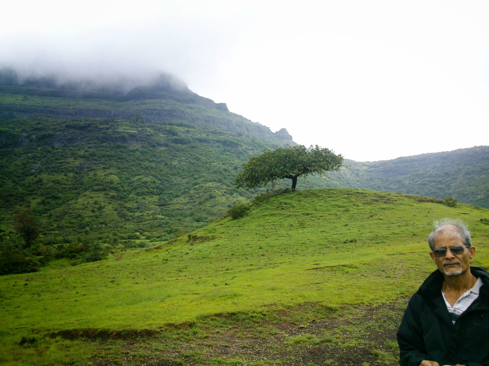
from the main Sahyadri range. It is surrounded by thick forest on all sides. We started climbing around eleven; the rains had vanished but it was mildly cloudy. Further it had rained earlier so everywhere there was the pleasant sound of running water; soon even our path had become a mini-waterfall.

The route was beautiful and shaded by trees. Skipping across lush paddy fields, we entered a forested route. The route eventually reaches a plateau. First there is a rocky clearing and then one re-enters the forest, reaching a point where there is a board announcing directions. A path demarcated by stones on either side, moves towards the cliffs which gave natural fortification to the fort. A gully with cliffs on either side has to be negotiated and there is a patch that is tricky when wet. There must have steps at one time here but they have been blasted. Remnants of steps lie on the top and one reaches an idol of a Hanuman with moustaches.

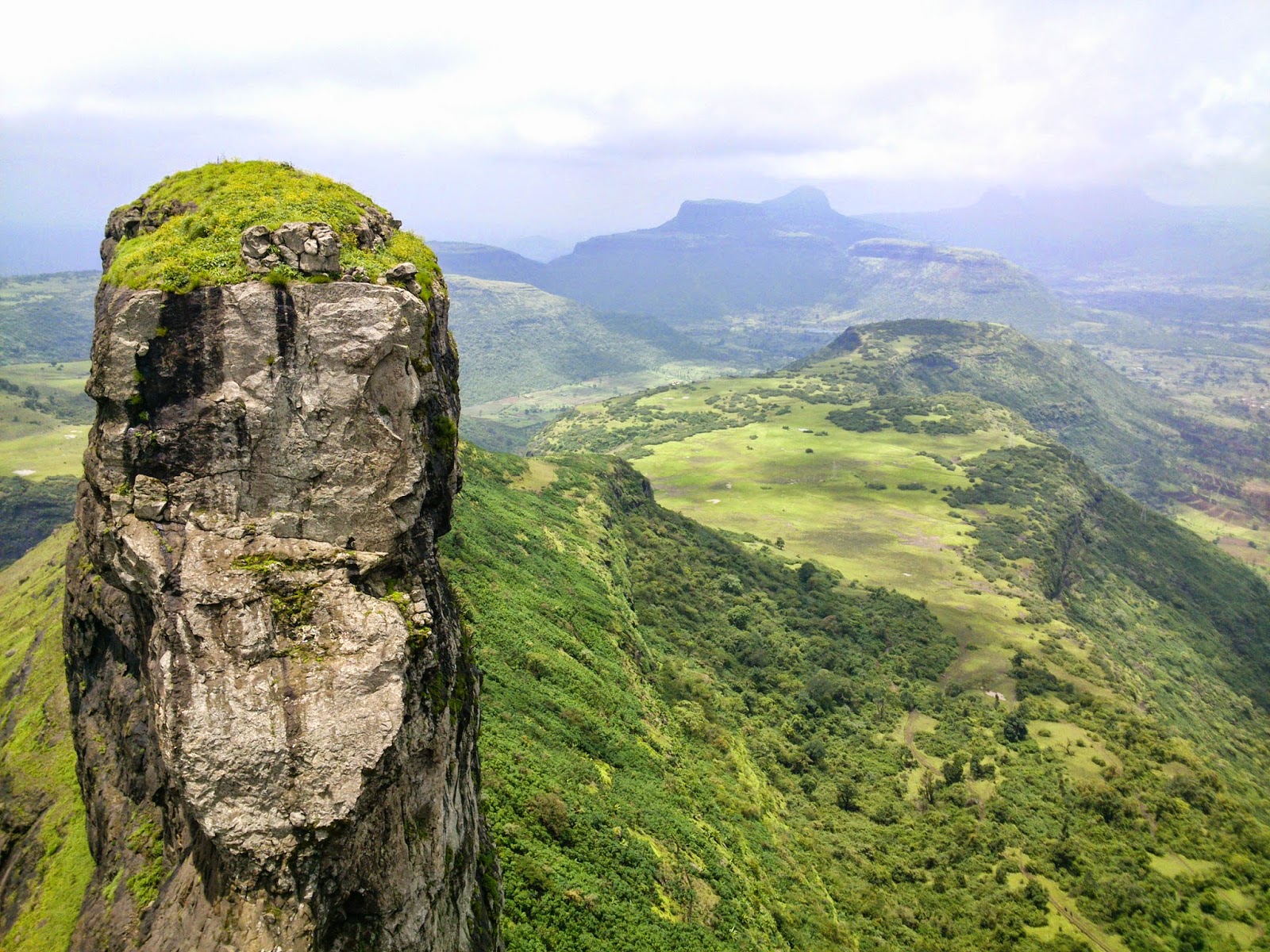
From here on one can explore the fort. We stopped at this point to gaze views of the other side of the fort; we could see the river Kundalika snaking through the green countryside. The top of the fort was covered with really tall grass, it was higher than our heads at places and completely obscured the path. However it was beautiful and peaceful at the top with interesting relics of the path; an impressive bastion, a carved tablet, a small ‘lingam’ of Shiva, some water tanks....


The fort somehow reminded me of Sudhagad which is not too far away from Surgad. Both forts have such beautiful surroundings that they are an absolute treat to visit and explore in the monsoon; I highly recommend them to novice trekkers. We spent some time by the edge of the fort, having lunch and listening to the breeze drifting through the overgrown grass and that is the way I will always remember this trek!

Overgrown grass on Ghersurgad

Link to pics:
https://picasaweb.google.com/115394767952469723630/Gherasurgad


Sunday 14 September 2014

, , , ,

INDEPENDANCE DAY WEEKEND HIKE (PART 2): MARKANDYA & JAWLYA FORT

After finishing Dhodap, we spent some minutes in Hatti village with a very hospitable old man who had a small shop. He offered us tea and told us about the origins of his people. After Rana Pratap’s defeat, many of his men got scattered all over India. One group came to Nasik region and settled in the area around Dhodap. When we left Hatti toward Babapur (our next destination village), we often stopped to ask directions and noticed the different features of the people in the villages.

From Babapur we had to make our way to the pass between Markandya and Rawlya-Jawlya. At this pass there is a tiny temple with a resident ‘baba’ who charges 100 bucks to oversee parked vehicles. From this point one has choice of going either of the two mountains. We decided to tackle Markandya first as the route was shorter and there was shelter at the top.

Since this a regular pilgrimage place, the route is well marked. Villagers are trying to make steps and at places have put up railings. It was all a work in progress as some construction material was strewn around. Luckily once we reached the upper plateau, there was only a small path and there seemed to be hardly anyone on top. There is a ‘mutth’ on the plateau where another ‘baba’ resides. It is a comfortable place to stay though the villagers are a little less hospitable; they only relented after ‘baba’ permitted us to stay. The plateau is huge and the top is quite a steep climb up. Since we did not have time, a couple of us went half-way up to a small Shiva temple. The actual temple of sage Markendeya is quite further up and was hidden in clouds.

Next morning we got up shivering with the sound of heavy rain on the tin roof. Luckily in some time, the rain receded and we set out in the mist. It took us barely 30-40 minutes to get down and by that time, the weather had changed. The sun was coming out....

Rawlya fort seen from Markandya plateau

At around 8.30 after keeping our heavy bags inside our car, we set out with necessities to go to Jawlya fort. A steep climb takes on to the vast plateau of Rawlya-Jawlya. Once on the grassy top, views of the countryside including Markandya are fantastic. We had no guide but a cowherd on the way gave us directions. The plateau of Rawlya-Jawlya is quite big and uninhabited save for one tiny settlement that lies between the two peaks. We saw no people but lots of cows and buffaloes, grazing their way to glory. And shitting a lot too! Soon our trails got lost and we had to walk through sticky mud trying to avoid cow-dung generously littered on the way! The cowherd had told us to go towards the right so we tried to follow that direction. But the mist was closing in and visibility turned low. Luckily we kept on moving to the right near the base of Rawlya and soon found a clearly marked, albeit muddy path. This path goes on the side of Rawlya until finally the hamlet comes into view.

The hamlet was basically just two huts. The villagers make ‘khava’ from the milk which is used in Indian sweets. We dragged our feet through muck to reach the huts where we asked for a guide but no one wanted to come. With no choice but to proceed without a guide we asked for directions and moved towards Jawlya which was half-hidden in clouds. There were clear trails but as we moved on, they became faint and we were not clear where we would start ascending.

Fortunately we met a villager who had brought his cows up to graze. After a little cajoling he agreed to take us to the fort. With a sickle he began cutting undergrowth and started on an ascent that was steep and obviously muddy (a feature of this place!). A path soon became visible but we would never have found it easily by ourselves. A short steep ascent led us to a small clearing in front of the rock face. Again, we would not have guessed one has to climb here. It was a thrilling rock climb, slightly exposed but no rope was needed. We eventually reached crumbling steps and remnants of a doorway. 

The doorway almost opens upwards like a hatch would; on top is a grassy expanse with almost no remnants of fortification. We walked on the small top towards to a set of tanks. It was beautiful with lovely views all around; in the distance we could make out our old friend Dhodap! One day maybe I would do the original plan of a cross country hike from Dhodap  and combine it with Rawlya – the other twin fort needs a rope.

Water tanks on Jawlya Fort

Coming back was easy and leisurely. We had done the trek in good time; it was one o’clock and we had a long flat walk back. The rain had stopped and so the mud was less squishy now! We walked back admiring the lovely quiet plateau, now revealing itself and the views around as the mist had completely lifted now. Soon we were back near our starting point; Markandya was in sight with its temple on the summit – eye-catching orange in colour. Walking back I was thankful to the rain gods for giving us views that would remain in our memories for years. The weekend was almost over now but what a weekend it was!

More pics at: https://picasaweb.google.com/115394767952469723630/DhodapJawlyaMarkandyaTrek


Directions: From Nasik, take the Bombay-Agra highway and take a diversion for Vani. From this road, one takes a diversion for Babapur, beyond which lies the pass for Markandya and/or Rawlya-Jawlya.

Sunday 31 August 2014

, , , , ,

INDEPENDANCE DAY WEEKEND HIKE (PART 1): DHODAP FORT

For a long time, I had wanted to go to Dhodap fort. My brother had been there thrice and had mentioned it as one of the most interesting forts to visit. I had missed going there all three times so when I sat to plan the Independence day weekend, Dhodap was high up on the list.

We set out on the 16th morning; three people from Mumbai and two from Pune, meeting at Nasik. We drove our car from the dry but cloudy skies towards Dhodambe from where a small road goes to Hatti village (or the village of Rajputs – more on that later).
Dhodap fort in the mists from Hatti village

As we reached Dhodambe, the weather completely changed; dark clouds loomed ready to break at any moment. By time we were at Hatti, it was pouring and all the hills were covered with thick clouds. I was expecting cloudy skies but no downpours like this so the important thing was to find a guide. The villagers asked us to seek Raju guide – however based on our experience PLEASE DON’T TAKE HIM! I had initially planned to do Dhodap and then hike across to Jawlya fort. My brother had done the trek from Markandya to Rawlya-Jawlya to Dhodap. However portly Raju said that the weather was bad and the way was risky. Other nosy villagers refused to answer questions about the route, flatly just ordering us to come down and drive down to Babapur for the other forts.
On the way to Dhodap fort


Since it was raining, we decided to take their word. However fifteen minutes later, the rain stopped, and things began clearing. I was already cursing Raju guide who had said there was knee deep mud on our cross-country route!
Dhodap is a beautiful fort; morderate from trekking point of view. There is not much forest around and trails are well marked so chances of losing your way are low. The route passes a lake and goes towards right side of the fort (dome side if you are looking at the fort). It climbs up to a plateau – this point is marked by a tank of potable water. On the plateau is Sonar’s village which has only two huts. One can explore the plateau as there some temples and ruins.
Water tank on Dhodap plateau

Ikhara pinnacle seen from Dhodap plateau

On the plateau the villagers have began constructing a broad (and frankly ugly) road to the top. The road has signposts of various wildlife that can be seen, though chances of encountering any seemed very low. Luckily the views around were wonderful and distracted everyone. A small rock patch has to be negotiated and soon one reaches a doorway.
Rock patch at Dhodap fort


Dhodap fort has wonderful fortifications; there are two rows of walls, several caves and bastions. Some of the ruins at the top are romantically desolate; a half arch here, an alcove on a ruined wall there. It is a truly a gorgeous fort with wonderful views. The weather was also cool and perfect. We could see Ikhara pinnacle and later on Rawlya-Jawlya forts.
Steps to second gate of Dhodap fort

Summit of Dhodap fort with ruins (right)


Dhodap has a distinctive dome-shaped summit accessible through rock climbing. It also has a long ridge like part beyond the summit which has a large gap or dyke. Standing at the dyke is a thrilling experience; it seems fearsome to navigate and the ridge beyond is mystifyingly out of reach. Again the charm is greatly reduced by the ugly railing installed recently but I guess safety is important. Despite these hiccups, the fort is a must-see for those trekking in Sahyadris. For me a long-cherised trek had been ticked off on the to-do list.

Dhodap fort

Dyke at Dhodap fort and view towards Rawlya-Jawlya forts


Directions: From Nasik, take the Bombay-Agra highway and take a diversion from Vadalibhoi naka to Dodhambe. From Dodhambe a road goes to Hatti village (where migrants from Rajasthan settled centuries ago).

More pics at: https://picasaweb.google.com/115394767952469723630/DhodapJawlyaMarkandyaTrek


Monday 18 August 2014

, , , , , ,

ROHIDA a.k.a VICHITRAGAD

Living in Mumbai, I have covered most of the nearby trekking spots over years. So when a chance came to spend a weekend in Pune, I was glad to have new options to consider. Rohida fort is not too far away from Pune and I had heard it was an easy trek so it made good sense to go there (though it being a Sunday I was afraid of crowds of trekkers).

Rohida fort seen from temple at base village Bazaarwadi.

I set out with my cousin and my uncle on Sunday morning at 6.30 towards the small town of Bhor, about one hour away from south Pune where we were based. The weather was cool and cloudy and the roads were empty. We even gave an old grandfather a ride when we stopped to ask him for directions. From Bhor we had to reach the base village of Bazaarwadi.

The village lies at the foot of the fort, surrounded by mountains. The fort itself seemed quite close though the citadel was high and lost in clouds. Near the village school there is a water tank from where the trek starts. One has to climb along a grassy ridge till a point where the stone markers appear. The villagers have clearly demarcated the path so it’s difficult to get lost.

The route steeply ascends and grass gives way to bushes. We could now make out two bastions at the two ends of the fort. Eventually the route reaches the first gate and then one enters a series of gates with intact fortifications. The last gate has two carved elephant heads on each side. The fort was initially shrouded in mist but a map at the top was a helpful indicator.

Rohida is also known as Vichitragad, though the reasons for that name seemed unclear. There is a temple of Rohideshwar at the summit; this is a lovely spot with tanks nearby. In fact the whole fort though not very big has been impressively maintained by villagers and an organisation. They have demarcated the routes, cleared the rubbish and planted trees. I was impressed and wished that others could take a hint from here. They had made most changes without spoiling the inherent beauty of the place.

After leisurely exploring the fort, taking in the views (which were fantastic as the clouds lifted away) and having food, we were ready to descend. As we descended it started raining and the wind was very strong. I had heard about strong winds on this fort and though I have experienced worse, I could imagine the force on a very rainy day.

By twelve we were comfortably back (we started at nine) and we even got home in time for lunch; surely one of the shortest treks I have had!

Water tank on top of Rohida Fort


Photos at:
https://picasaweb.google.com/115394767952469723630/RohidaFort


Monday 4 August 2014

, , , , , , , ,

TREK TO MATHERAN VIA ONE-TREE HILL - EID SPECIAL HIKE


On the way to Matheran from the Shivaji Ladder/One Tree Hill route


After a not so wet trek we were waiting for the rain on the weekend. Saturday went by with hardly a drop, so we called off the Sunday program, only to wake up next day amid pouring rain. Since Tuesday was Eid we decided to take advantage of the holiday and planned a trek close to Mumbai. And what better place is there to trek near Mumbai than Matheran!

We decided to take a later morning train than the usual early one to Karjat. As I walked to Dadar station, it was raining already. The portent for the weather was already good. As we alighted at Karjat it was pouring. After a breakfast of tea and vada pav we took a vehicle to Borgaon which lies off the Karjat-Chowk road. We could take the road up to Ambewadi from where the trek to Matheran via Shivaji Ladder up to One-Tree Hill starts.

Ambewadi overlooks the backwaters of Morbe Dam. A well near the village is the marker for the starting of the trek. From here a sharp grassy ridge leads towards Matheran. The clouds were playing hide and seek with us, offering us glimpses of the valleys and mountains around. Everything was lush and green and wet as it should be on a monsoon hike. After some steep climbing we started entering the forest. My friend remarked it was the enchanted forest and it couldn’t be truer. A lovely walk through thick forest in the middle of heavy rain was just what we had been waiting for.

The pièce de resistance of the trek is the Shivaji Ladder which is a name given to the route by which Shivaji is said to have climbed up to Matheran. A small shrine is a marker for this route and there is actually no ladder but a waterfall through which one has to climb. The route skirts the waterfall here and there but at times you just climb through the waterfall. Climbing between the cascading water swollen with rain was a high point!

Eventually the route leaves the waterfall towards the end and one climbs upto the One-Tree Hill point on Matheran and the dark forests of the hill station greet you. From here its a long flat walk to the main market. In the middle of the week, on a rainy day, there were very few people around and the lovely roads of Matheran were misty and moody, just the way they should be!


My very first hike was this very one many years ago. At that time we started from Chowk phata on Bombay-Pune road, through the valley which is now submerged by the waters of Morbe Dam. Ambewadi was a half-way point on that trek. The route to One-Tree Hill has always been a beautiful hike and it was unimaginably beautiful to me on that very first hike. Years later it still is a fantastic trek. Change is inevitable but the newer hikes feel somewhat inferior versions of the old ones (I had a similar experience with the changed Shidi Ghat at Bhimashankar). I miss the earlier experiences when things were less accessible, there were fewer trekkers and even less litter.  All that is left now are the awesome memories of experiences that are now just no longer possible.

Pics at:
https://picasaweb.google.com/115394767952469723630/MatheranViaShivajiLadder


Thursday 24 July 2014

, , ,

TREK TO TANDULWADI FORT

The monsoon in 2014 was absentee in June so I had to wait avidly till July for any trekking to begin. Luckily the rains arrived in July and I was off initially to Bhimashankar (again). That trek always gets trekkers by the dozen during rains, though this time there were much fewer groups. However the thought of going to an offbeat place where one could almost enjoy the location exclusively for a while was tempting!
So I zeroed on to Tandulwadi fort, a small mountain just outside the western suburbs of Mumbai. We took a fast train to Dahanu and got down at Safale station (second station after Virar). From Safale one can either get a bus or a shared auto to go to Tandulwadi phata. From here a short walk on the tar road takes one to the base village from where this fort is easily visible.

Tandulwadi fort from base village


We had cloudy skies so there was promise of rain when we started. The trek starts from a small pond outside the village. One has to go from the left side of the pond and ascend gradually. The ascent takes us to a plateau. The first point on plateau is kind of a pass; it windy out here. There are a few paths that meet at this point and we took the right one. The route then on traverses this plateau and eventually enters into the forest near the main massif of the fort. This is where things get a bit tricky and a guide would be helpful.
We back-tracked a bit but found the correct path. We luckily met two other hikers who were also lost and phoning their friends for directions. We followed our instincts and traversed a bit more before entering the forest. Ultimately we met the two guys who had more luck with one of our ‘failed paths’. Through the forest now the climb is steep and after a solid climb of half an hour we were on top. Rain was scarce but that meant lovely views all around.
On the top one has to walk for a while through lovely forest (especially a grove of cacti) till one starts seeing remnants of the fort. We saw a carved tank that was empty. We saw some walls and a few steps. Other than that there is hardly anything of the old fort left. On top we had lunch as we gazed on the surrounding countryside. We did see the confluence of two rivers which was great. The wind was strong on the top and soon we had a burst of rain that continued till we descended.

Descent was quicker and we were back quickly to the base village. We took an auto (charge ten bucks per person) to Safale station and took a train to Dadar at quarter past four. This is a comparatively easy outing in the rains and easily accessible from Mumbai – we were home comfortably by six!

Pics posted at: