


For a long time, I had wanted to go to Dhodap fort. My
brother had been there thrice and had mentioned it as one of the most
interesting forts to visit. I had missed going there all three times so when I
sat to plan the Independence day weekend, Dhodap was high up on the list.
We set out on the 16th morning; three people from
Mumbai and two from Pune, meeting at Nasik. We drove our car from the dry but
cloudy skies towards Dhodambe from where a small road goes to Hatti village (or
the village of Rajputs – more on that later).
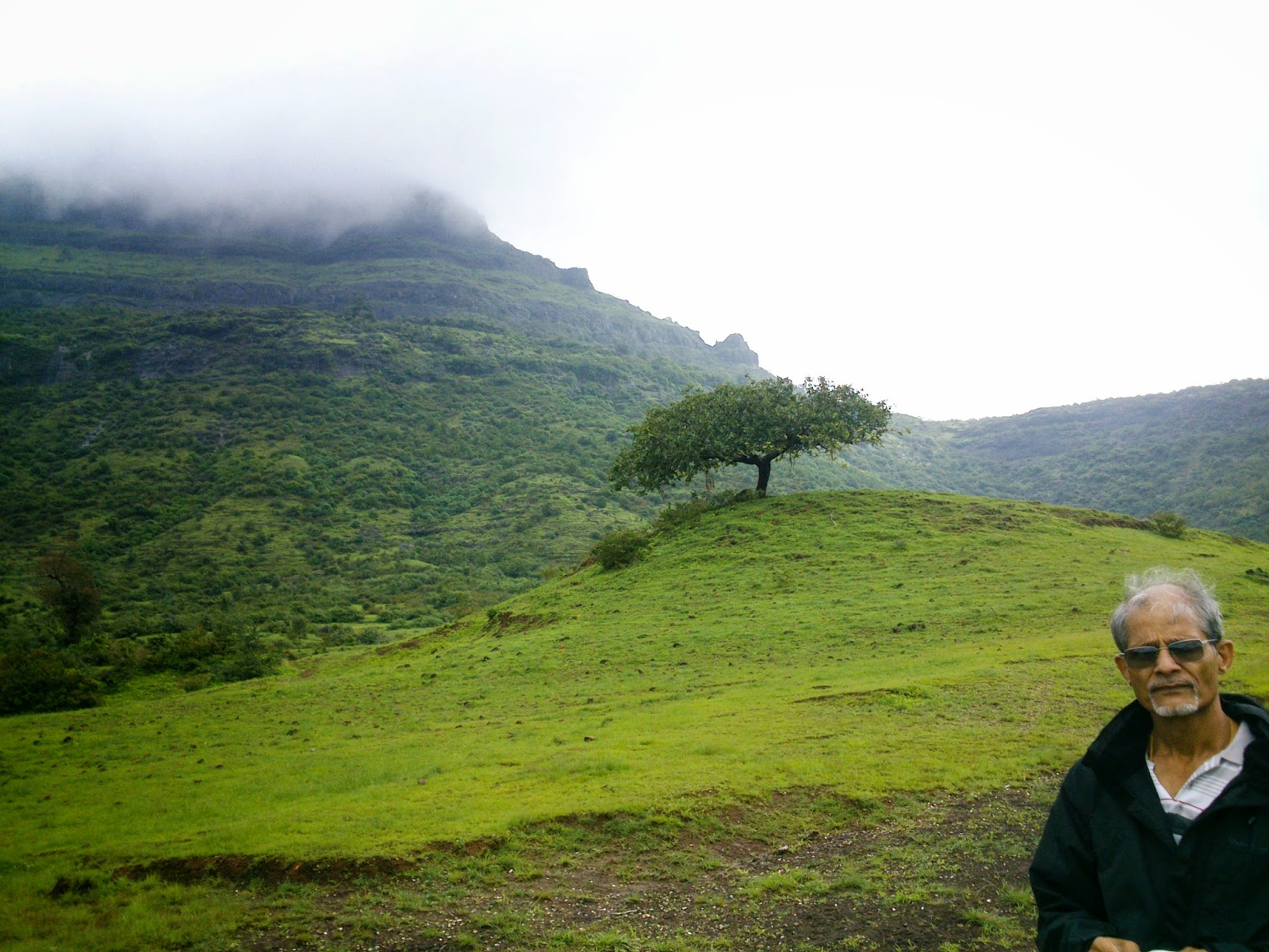
 |
| Dhodap fort in the mists from Hatti village |
As we reached Dhodambe, the weather completely changed; dark
clouds loomed ready to break at any moment. By time we were at Hatti, it was pouring
and all the hills were covered with thick clouds. I was expecting cloudy skies
but no downpours like this so the important thing was to find a guide. The
villagers asked us to seek Raju guide – however based on our experience PLEASE
DON’T TAKE HIM! I had initially planned to do Dhodap and then hike across to
Jawlya fort. My brother had done the trek from Markandya to Rawlya-Jawlya to
Dhodap. However portly Raju said that the weather was bad and the way was
risky. Other nosy villagers refused to answer questions about the route, flatly
just ordering us to come down and drive down to Babapur for the other forts.
 |
| On the way to Dhodap fort |
Since it was raining, we decided to take their word. However
fifteen minutes later, the rain stopped, and things began clearing. I was
already cursing Raju guide who had said there was knee deep mud on our
cross-country route!
Dhodap is a beautiful fort; morderate from trekking point of
view. There is not much forest around and trails are well marked so chances of
losing your way are low. The route passes a lake and goes towards right side of
the fort (dome side if you are looking at the fort). It climbs up to a plateau
– this point is marked by a tank of potable water. On the plateau is Sonar’s
village which has only two huts. One can explore the plateau as there some
temples and ruins.
 |
| Water tank on Dhodap plateau |
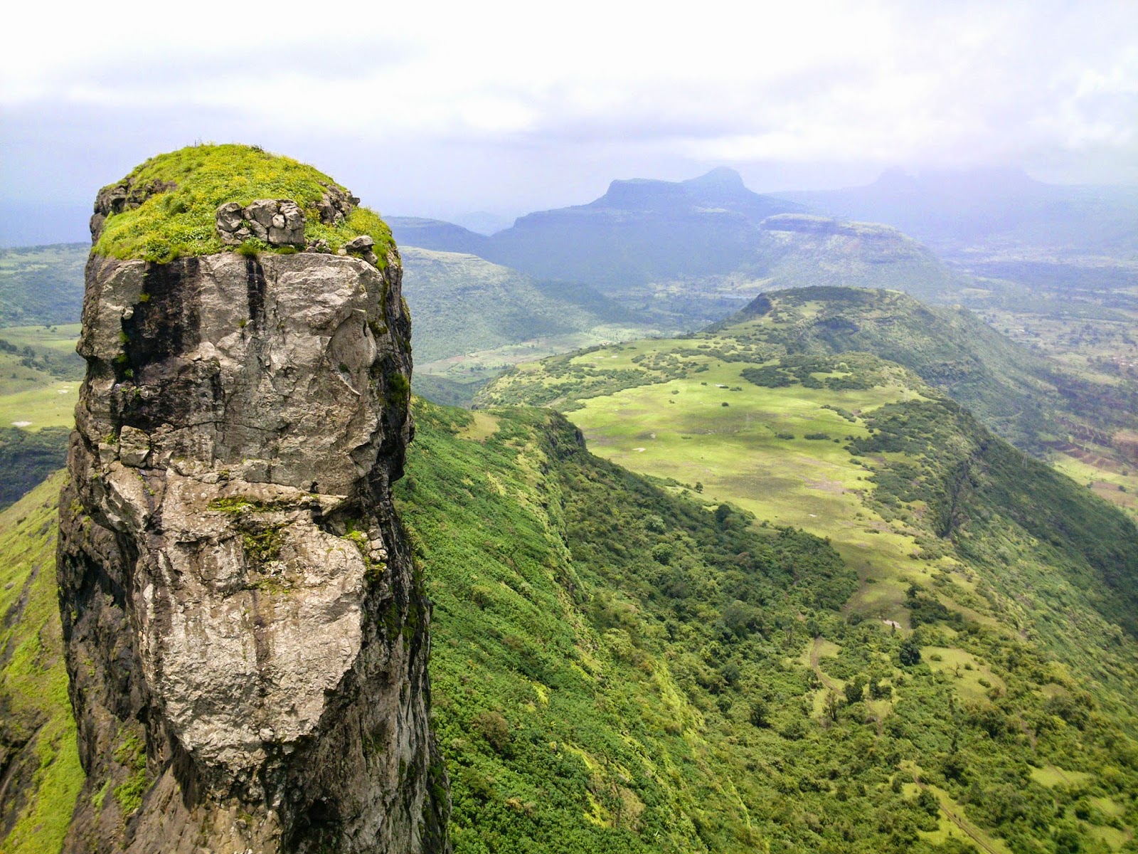
 |
| Ikhara pinnacle seen from Dhodap plateau |
On the plateau the villagers have began constructing a broad
(and frankly ugly) road to the top. The road has signposts of various wildlife
that can be seen, though chances of encountering any seemed very low. Luckily the
views around were wonderful and distracted everyone. A small rock patch has to
be negotiated and soon one reaches a doorway.
 |
| Rock patch at Dhodap fort |
Dhodap fort has wonderful fortifications; there are two rows
of walls, several caves and bastions. Some of the ruins at the top are
romantically desolate; a half arch here, an alcove on a ruined wall there. It
is a truly a gorgeous fort with wonderful views. The weather was also cool and
perfect. We could see Ikhara pinnacle and later on Rawlya-Jawlya forts.
 |
| Steps to second gate of Dhodap fort |
 |
| Summit of Dhodap fort with ruins (right) |
Dhodap has a distinctive dome-shaped summit accessible
through rock climbing. It also has a long ridge like part beyond the summit
which has a large gap or dyke. Standing at the dyke is a thrilling experience;
it seems fearsome to navigate and the ridge beyond is mystifyingly out of
reach. Again the charm is greatly reduced by the ugly railing installed
recently but I guess safety is important. Despite these hiccups, the fort is a
must-see for those trekking in Sahyadris. For me a long-cherised trek had been
ticked off on the to-do list.
 |
| Dhodap fort |
 |
| Dyke at Dhodap fort and view towards Rawlya-Jawlya forts |
Directions: From Nasik, take the Bombay-Agra highway and
take a diversion from Vadalibhoi naka to Dodhambe. From Dodhambe a road goes to
Hatti village (where migrants from Rajasthan settled centuries ago).
More pics at: https://picasaweb.google.com/115394767952469723630/DhodapJawlyaMarkandyaTrek
More pics at: https://picasaweb.google.com/115394767952469723630/DhodapJawlyaMarkandyaTrek
0 comments:
Post a Comment